- +57 317 887 8734
- dianasanchez@vyve.com.co
- Lun - Vie: 8:30 - 18:00
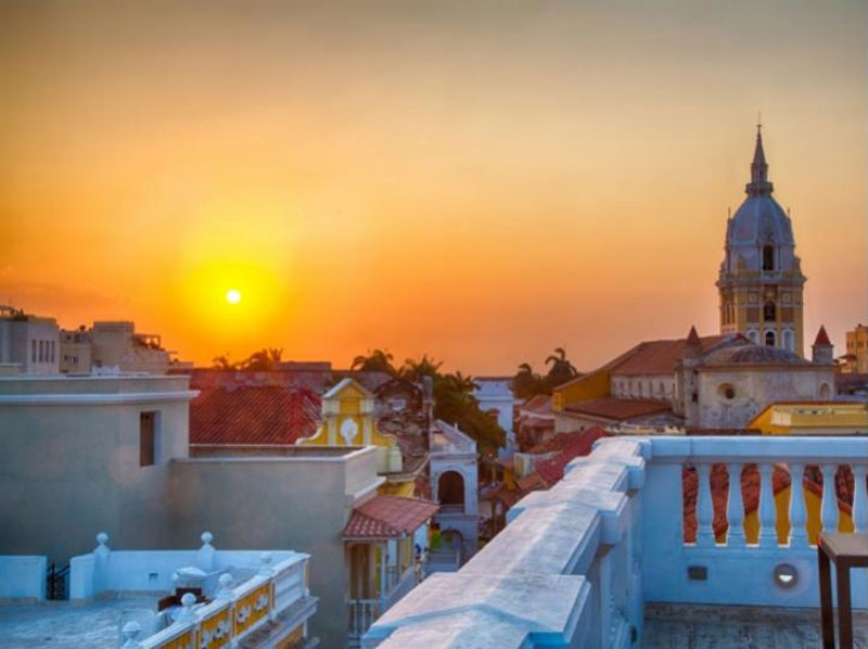
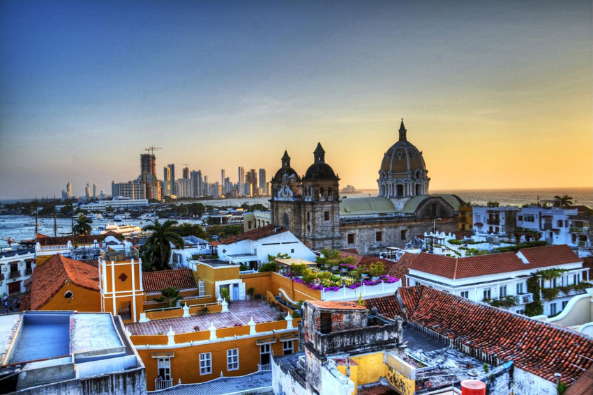
Cartagena
Cartagena de Indias D. T. Y C.
- Greater Colombian Caribbean Region. Much more than Caribbean.
- Capital of the department of Bolívar, officially named Tourist and Cultural District in the year 2002.
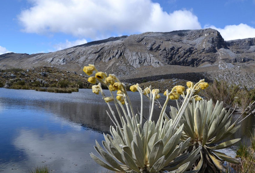
- Altitude 2 meters a.s.l
- Declared a World Heritage Site by Unesco in 1984.
Known as the Walled City, it was declared a National Heritage of Colombia in 1959. It is a tourist and cultural district, it is also known as the stone corralito, among other names. Cartagena is located on the shores of the Caribbean Sea, it is a beautiful city that attracts millions of tourists around the world. It is noteworthy that, although the climate tends to be hot all year round, the presence of a breeze makes the climate pleasant. The bay of Cartagena de Indias receives the main contribution from the Dique channel, a tributary of the Magdalena River, acquiring special conditions of productive wealth for purposes of fishing and aquaculture uses.
In pre-Columbian times it was the territory of the Kalamari indigenous people of the Caribe family, who based their diet mainly on shellfish, fresh fish and saltwater, developing a mixed economy and basic manufacturing. With the arrival of Rodrigo de Bastidas in 1502, it received the name of Bahía de Cartagena de Indias, because it was so closed to Cartagena, Spain, and it was later founded in 1533 by Pedro de Heredia.
In the Caribbean Sea to the north of Colombia, since the discovery of America, it was the main gateway to the interior of the country and the continent, in this way it was consolidated as a port of great importance, where the stories of pirates and privateers who came from Europe with intentions of conquest and looting of the treasures piled up there were appeased by its imposing walls, which today are one of its most striking attractions.
Cartagena, after being declared a World Heritage Site by the Unesco in 1984 it established its main cultural and heritage sites at:
- The main entrance to the historic center is the Clock Tower or Boca del Puente, built on the wall in the 19th century.
- The Gethsemane neighborhood and the Pegasos pier.
- Within the Walled City is the Plaza de los Coches, surrounded by colonial mansions and presided over by the statue of Pedro de Heredia; the Casa del Marqués del Premio Real, the Customs House, the Church and the Convent of San Pedro Claver, built in the 17th century by the Jesuits and where the remains of San Pedro Claver, one of the defenders of the cause of the black population. There are also the current building of the Mayor's Office, the House of the Inquisition, the Gold Museum and the Museum of Modern Art where exhibitions of Colombian artists are presented.
- The Castillo San Felipe de Barajas, a Spanish fortress built to protect the city from the siege of enemy troops.
- Among the spas are Bocagrande, Laguito, La Boquilla, Castillo Grande and the islands of Tierra Bomba and Rosario.
Learn more about about
the warm and cheerful hero city
The mixture of different races gives rise to a diverse culture that is flooded with indigenous, African and European traditions. The color of its streets, its architecture, gastronomy and the characteristic joy of its inhabitants show this fact.
Musical rhythms vibrate in its streets, a champeta, a cumbia, a vallenato, a joint, a salsa, a mapalé or a son de negro invite you to dance during the day or at night in Cartagena.
Very close to Cartagena, in the seductive Colombian Caribbean Sea, extraordinary beaches are located to enjoy the tropical climate, its warm waters, its nature and dazzling beauty.
Barú Island
The Barú peninsula is a coastal area located to the south and 45 minutes by boat from Cartagena de Indias Colombia, famous for its white beaches and turquoise water. It is separated from the territory by the Canal del Dique. Until 2014, the only way to cross it was by raft, or its variants. It was in that year when the so-called “Barú Bridge” was inaugurated.
Today it is a place of great tourist boom. Most of the beaches are private, owned by individuals or tourist enterprises, except for Playa Blanca, which is the only public beach.
In the sea waters in front of Barú, the famous Battle of Barú was fought in 1708, during which the galleon San José sank.
Rosario Islands
The Rosario Islands (or Corales del Rosario) is a small archipelago formed by about 28 islands, which is part of the insular zone of Cartagena de Indias, with a land area of 20 hectares (0.20 km²) located off the coast of the Department of Bolívar at the same latitude as the Barú peninsula. In them is located one of the natural national parks of Colombia created to protect one of the most important coral reefs on the Colombian Caribbean coast.
The park has an area of 120,000 ha, from the highest tide line to the depth of 50 meters, it includes the submarine platform and the coral reefs to the west of the Barú peninsula, the reefs of the archipelagos of Nuestra Señora del Rosario and San Bernardo and the submarine platform between these two archipelagos, as well as the islands of Tesoro, Rosario, Múcura and Maravilla.
Some Rosario islands are:
- Isla Grande
- Isla Marina
- Isla de Roberto
- Isla del Tesoro
- Isla Caribarú
- Isla Arena
- Isla Rosario
- Isla Pirata
- Isla Fiesta
- Isla Cagua
- Isla Macaví
- Isla San Quintín
- Isla Pavitos
- Isla El Peñón
- Isla Majayura
- Isla María del Mar
- Isla Pajarales
- Isla San Martín
- Isla Gigi
- Isla Coralina
- Isla Pescadito
- Isla Tijereto
- Isla Rosa